Protect Ecosystems. Respond Faster. Act Sustainably.

From mangroves to mountain zones, FEDS helps you track environmental change, monitor wildlife, and manage climate risks, all without disturbing the flora and fauna.

Why Traditional Environmental Monitoring Falls Short

Poacher activity often goes undetected in remote areas

Flood zones are difficult to access in real-time

Air quality data is limited or unavailable in many regions

Wildlife patterns are difficult to track at scale

Soil conditions shift without early warning indicators

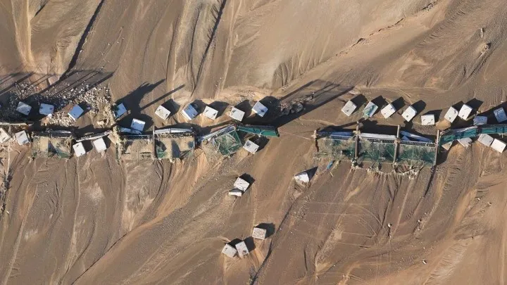
Teams lack equipment to survey rough or inaccessible terrain

Manual data collection is slow and inconsistent

Traditional monitoring methods can disturb local wildlife

Monitor the Planet.
Responsibly and Without Disruption.

Our environmental solution is built for teams who need clear insights—not field disruption. FEDS uses NDVI mapping, AI analysis, and smart sensors to monitor habitats and detect change.

01

Rapid Response During Natural Emergencies

Our team deploys drones for wildlife conservation and emergency analysis within hours, enabling governments to assess impact and coordinate aid faster.

02

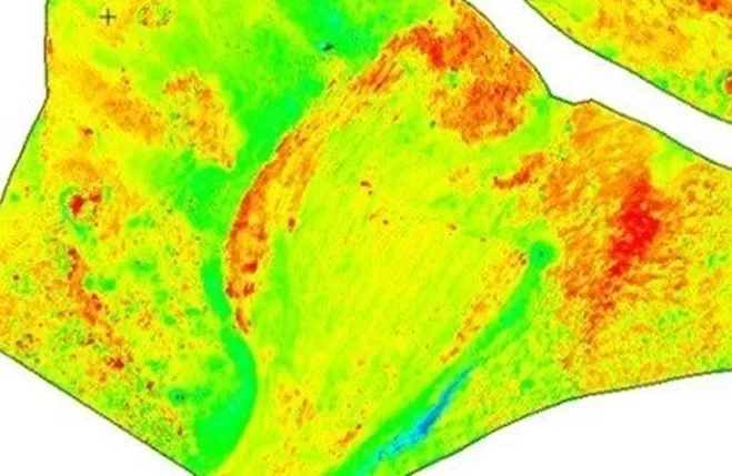
AI-Assisted Classification of Soil, Vegetation, and Water

We use AI models trained on the region’s largest drone datasets to classify NDVI zones, soil conditions, water spread, and topographical shifts, delivering insights that reflect the true terrain.

03

Aerial Seeding for Reforestation and Conservation

We enable high-precision mangrove and forest seeding via drones for wildlife conservation — supporting habitat restoration across coastal and desert regions.

04

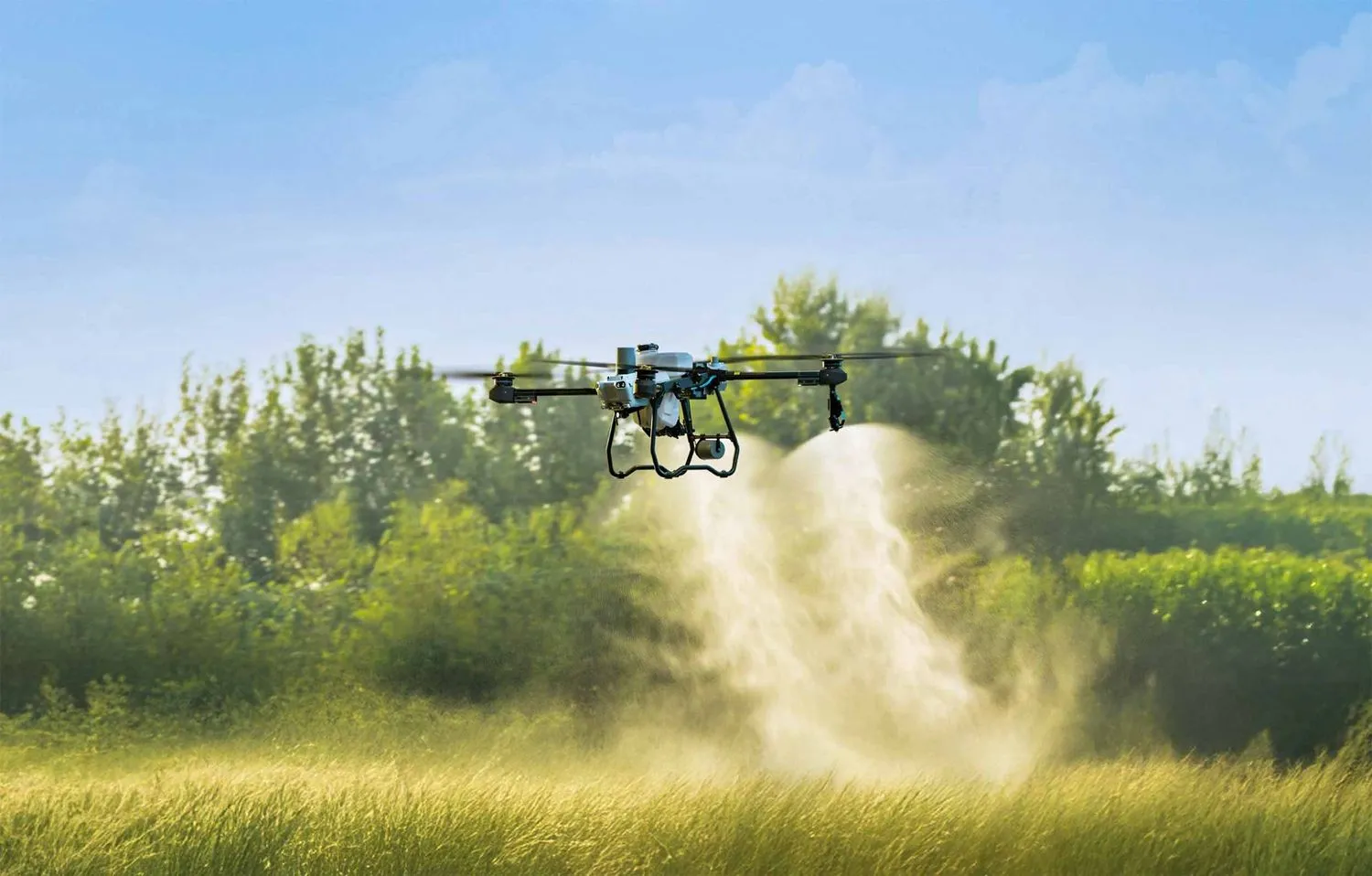
Air Quality and Wildlife Monitoring with Sensor Payloads

Mounted sensors collect air quality and atmospheric data in hard-to-reach zones. We also conduct low-impact drone wildlife protection missions for wildlife tracking and anti-poaching missions.

Built for Sustainable Impact and Field Flexibility

FEDS uses rigorously tested, brand-agnostic drone platforms and advanced sensors selected through real-world field validation. We only deploy equipment that meets our standards for reliability, data quality, and mission success.

Drone Platforms and Payloads

Drones equipped with NDVI, RGB, and air-quality sensors
End-to-end flight planning tailored to each environment
No load trucks or invasive ground crews required
Docked drone systems deployed for autonomous wildlife and poacher activity monitoring

Data Accuracy and Coverage

Trained AI models for NDVI classification and habitat tagging
GIS-ready outputs for resource planning or restoration
Proven impact in deserts, coastal zones, forests and wetlands.

Processing and Analysis

Deliverables aligned with agency workflows and formats
Raw or processed data based on client preferences
Outputs compatible with GIS and remote sensing tools

Security and Compliance

Compliant with UAE and KSA Aviation, Commercial Drones and Municipal Regulations.
FEDS Drone-powered Solutions is certified on international UAS operational procedures (ISO 21384-3:2023), quality management (ISO 9001), OH&S (ISO 14001, ISO 45001) and for secure data storage and encrypted delivery (ISO 27001).

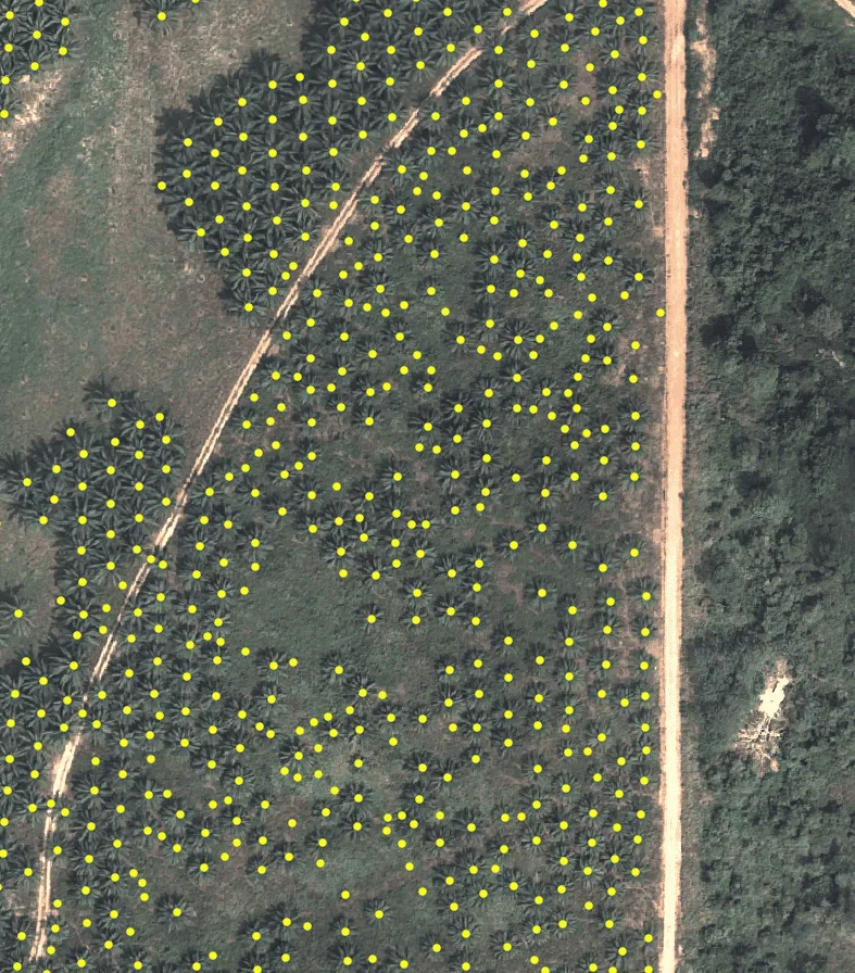
35,000+ Palm Trees Counted in Minutes, Not Months

CLIENT

UAE Government Entity

THE CHALLENGE

Counting palm trees across large farms from orthomosaics was slow and error-prone, delaying irrigation planning, yield estimates, and governance tasks like GPS-level inventories. The client needed exact counts across varied palm types and terrains, delivered far faster than manual methods.

FEDS SOLUTIONS

We trained and validated a palm-tree detector on high-resolution drone imagery, iterating across 769 scenarios and 5,785 labelled trees to reach ~97% precision/recall. The workflow turned a 1 km² manual count that took ~120 hours into an under-1-hour process (about 11,900% faster) while maintaining 95–97% accuracy across countries and image resolutions.

Results
35,000 palms counted on a 5 km² farm in ~4 hours at 97.5% accuracy.
~99.16% time saved vs. manual counting, with ~97% precision and recall.
Inventory-ready counts and locations to support irrigation design, yield forecasting, and food-security planning.