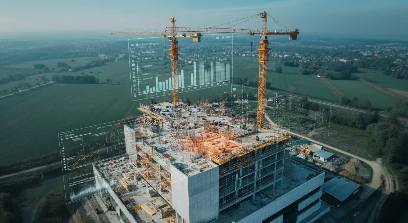
From Ground Truth to Boardroom Views

Get geo-referenced drone data and visual progress timelines, so managers, contractors, and stakeholders can see the full picture, month after month. With Drone Construction Monitoring, you get accurate, real-time insights into your project’s progress.

Silhouette of a construction site with cranes and a drone flying at sunset, showing battery and temperature icons on screen.

Why Construction Monitoring Often Falls Short

Progress updates are slow and inconsistent, and hard to verify

Red background with a subtle grid pattern of rounded squares and small dots at intersections.

Rework increases due to lack of as-built comparisons

Black grid pattern with squares and central dots on a dark background.

Historical records are incomplete or scattered across vendors

Red background with a subtle grid pattern of rounded squares and small dots at intersections.

Teams rely on fragmented data from multiple vendors

Black grid pattern with squares and central dots on a dark background.

Ground access delays monitoring and adds safety risks

Red background with a subtle grid pattern of rounded squares and small dots at intersections.

Reporting takes too long to influence real-time decisions

Black grid pattern with squares and central dots on a dark background.

Specialised equipment and staff raise operational costs

Red background with a subtle grid pattern of rounded squares and small dots at intersections.

Reworks result in wasted time, materials, and adds unnecessary emissions

Black grid pattern with squares and central dots on a dark background.
Aerial Timelines That Keep Everyone Aligned

We fly the same drone path each month to create a consistent visual record of site progress. Paired with static timelapse cameras, you get reliable updates that contractors, consultants, and stakeholders can all reference, without stepping on site.

Construction worker in safety vest and helmet operating a drone in front of high-rise buildings under construction.
Aerial view of a construction site with two tall cranes and augmented reality graphics showing building data and charts.
Compare Plans With What’s Actually Built

Our geo-referenced data helps you overlay as-planned designs with as-built reality. Spot delays early, avoid scope creep, and keep your project timeline intact, without relying on scattered reports or manual photos.

No Delays. No Subcontractors. No Data Gaps.

From permit to final report, every flight and file is handled in-house by FEDS. That means faster turnaround, full control of quality, and zero gaps in your project’s historical data archive, ensuring seamless construction monitoring every time.

Construction worker in a high-visibility vest and white helmet operating a drone near a building site with cranes.

Technical Capabilities

01

Drone Platforms
and Payloads

Person in orange and blue clothing preparing a large drone on the ground in an outdoor setting.

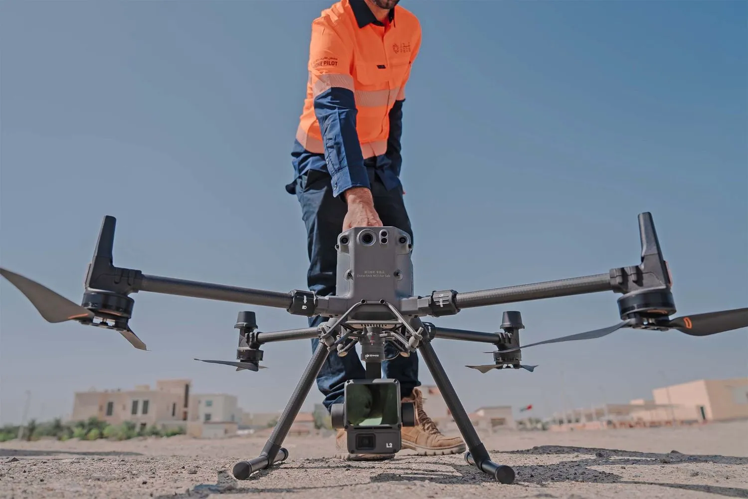
RGB-equipped drone fleet with high-resolution sensors and fixed-position timelapse cameras.
Flight paths and camera positions are optimized to match project timelines and key milestones.

02

Data Accuracy
and Coverage

Three men in gray uniforms working together to inspect a device mounted on a pole outdoors.

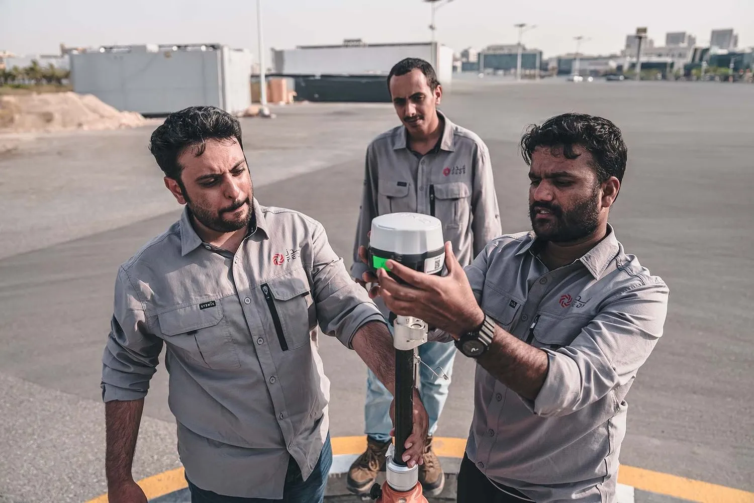
Captures with ground sampling distances (GSD) as precise as 5 cm.
Repeatable aerial routes ensure consistent progress tracking across large, active construction zones, perfect for construction progress monitoring.

03

Processing
and Analysis

Aerial view of a bridge spanning a dry, rocky riverbed with some green vegetation and buildings on one side.

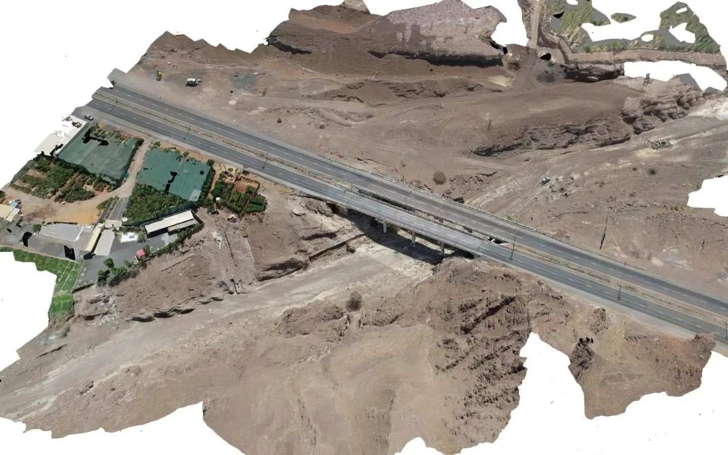
Millions of images stitched, processed, and layered with plan data.
Outputs include annotated progress maps, visual timelines, volume estimates, and cloud-based reports.

04

Security
and Compliance

Drone flying over desert terrain near a white vehicle with Dubai Civil Aviation Authority logos under a cloudy sky, with text stating compliance with international and local standards.

Aligned with UAE aviation and municipal regulations, FEDS is an ISO 21384-3:2023, ISO 9001, ISO 14001, ISO 45001 and ISO 27001 certified entity.

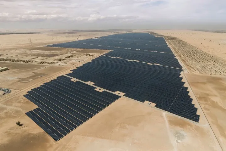
Proven Capability at Scale

CLIENT

Sterling Wilson – Noor Abu Dhabi Solar Plant

THE CHALLENGE

Multiple contractors were working across a massive site on tight deadlines. Traditional monitoring couldn’t provide timely updates, and manual aggregation delayed reporting.

FEDS SOLUTIONS

We flew monthly drone missions over the entire site, capturing high-resolution images with 5 cm GSD and 7 cm accuracy. Data was processed overnight to deliver orthomosaics, volume calculations, and full historical records.

Large solar panel farm installed in a desert landscape under a cloudy sky.
Results
Full site mapped in one day, with deliverables ready the next
17 orthomosaics and 105,000+ images used to track and analyze progress
Project delivered on time — a rare achievement for a megaproject of this scale
Analysis of Plant Compounds showing structure and analytical data on a dark background.